Loading...
Ultras · US · OR

Wy’east Trailfest

50 Miler · 50 Mile
On the calendar
The date is set. Entry has not opened. Registration opens January 1, 2027.
Race dateJuly 24-25, 2027
Duration2 days
Start5:30am
Whenin 273 days

Who's going to Wy’east Trailfest?

Free. You can start with nothing.

Free, and always will be. NavRun makes money from race-day planning for runners who want it, never from this. Ultras change constantly, sometimes the morning of. Always confirm with the race director and the official website before you rely on anything here.
Distance From the name
50 Mile The race calls this course “50 Miler” and hasn't published a measured distance. Trail courses often run long.
Climb The race
10,650 ft
Descent The race
8,800 ft
High point
not checked yet
Time limit The race
15:30:00
Aid stations
9
Started
not checked yet
Finished
not checked yet
Finish rate
not checked yet
The course

Where it goes point to point · 9 aid stations · rust marks a stop your crew can reach

No official GPX on file yet. These are the aid station coordinates, not the trail. Have the GPX? Send us the link.

A point-to-point mountain route that shuttles runners to the east edge of Mt. Hood National Forest’s Ponderosa backcountry, runs ridgeline trails back onto the volcano, up into the alpine, then down to the finish at Mt. Hood Meadows.

The 3.2 miles between the two Ski Patrol aid stations are the most exposed, steep and technical on the course: the Wizard Trail climbs 1500' in 1.6 miles to a turnaround at the 8000' level, where runners punch their bib.

The race

What this one is

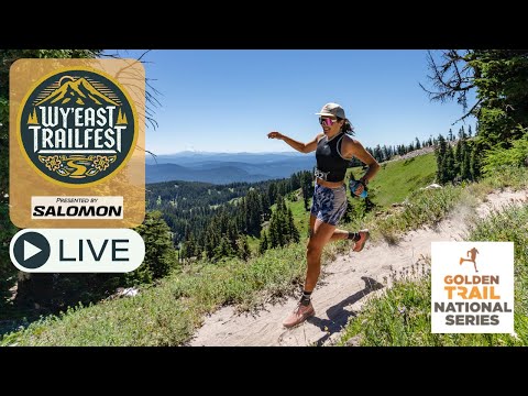
Wy’east Trailfest is a weekend of mountain trail running at Mt. Hood Meadows Ski Area on Mt. Hood, Oregon. Saturday has the 50 Miler, 50K, 28K and 14K, which reach 8000 feet on the volcano. Sunday has the Half Marathon, the 8K (5 miler) and a Kids Race. Wy’east is the native ancestral name for Mt. Hood.

Getting in

Getting in Entry, lottery and what the race asks of you before race day.

Lottery
not checked yet
Lottery opens
not checked yet
Lottery draw
not checked yet
Field cap
not checked yet
Registration
UltraSignup ultrasignup.com
Qualifying
not checked yet
Minimum age
not checked yet
Transfers
not checked yet
Deferrals
not checked yet
Crew access, pacers and drop bags

The rules that shape your day Anything marked "not checked yet" is a gap in what we hold, never a no from the race.

Crew allowed
Yes daybreakracing.com
Vehicles per runner
1 daybreakracing.com
Pacers
No daybreakracing.com
Muling
not checked yet
Drop bags
Yes daybreakracing.com
Cupless
Yes daybreakracing.com
Course marking
not checked yet
Night running
not checked yet
Dogs
not checked yet
Headphones
not checked yet
Crew rules
Crew/supporters are welcome at Aid Stations #1, 2, 5, 6 & 7 and of course the Finish Line area for runner support. Crew and spectators must follow race rules and directions given by an event official, medical personnel or aid station captain. daybreakracing.com
Pacer rules
No pacers allowed. daybreakracing.com
Drop bag rules
Drop bags will be available at Aid Station #2 & #5. Drop bag size must be smaller than a 20L day bag (shoe box size), made of durable, water-resistant material and less than 5lbs. Please label your drop bags with your name, race, bib number and aid station location in permanent marker. Drop bags will not be returned to the race staging area until after the aid station cutoff and shutting down after race sweepers arrive. daybreakracing.com
Cutoff philosophy
Race cutoffs exist for several reasons, primarily safety and keeping the race on its permitted schedule. Cutoff times indicate when a runner must leave the aid station. daybreakracing.com
Aid stations

Every stop, and what you get there ● yes   ○ no   ? nobody has checked   – does not apply to this race

Mile Station Cutoff Crew access Bag Pacer Med To next
0.00 Underhill Site
None · spotty cell service · Signal wrong?
? ● ? ? ? 8.80
8.80 Fifteenmile
None · spotty cell service · Signal wrong?
? ● ? ? ? 10.10
18.90 Surveyors Ridge
None · no cell service · Signal wrong?
11:15am ● ● ? ? 7.60
26.50 High Prairie 1:45pm ○ ○ ? ? 9.30
35.80 Bennett Pass 4:30pm ○ ? ? ? 4.30
40.10 Umbrella
None · cell service · Signal wrong?
5:45pm ● ● ? ? 2.50
42.60 Ski Patrol
None · cell service · Signal wrong?
6:30pm ● ? ? ? 3.20
45.80 Ski Patrol 2 ? ● ? ? ? 4.20
50.00 Mt. Hood Meadows
None · cell service · Signal wrong?
9:00pm ● ? ? ? ?
Driving your crew

Getting your people there 4 stops with directions the race published.

Underhill Site mile 0.00

From Mt. Hood Meadows (30 min./21 miles travel time): Depart Mt. Hood Meadows down Mt. Hood Meadows Dr. for 1.6 mi. Continue straight over the Hwy 35 overpass and on-ramp onto Hwy 35N (toward Hood River). Drive Hwy 35N for 6.9 miles. Turn RIGHT onto Forest Road 44 and follow up for 5.2 miles. Veer RIGHT to continue on Road 44 for 6.6 miles. Underhill Site is on the right.

Parking. Drop-offs must park out on the main 44 Road, fully off of the pavement. Do not enter the Underhill Site: it is for shuttle bus turnaround only and is a small location.

daybreakracing.com
Fifteenmile mile 8.80

From Mt. Hood Meadows (32 min/21.6 miles): Depart Mt. Hood Meadows down Mt. Hood Meadows Dr. for 1.6 miles. Continue straight over the Hwy 35 overpass and on-ramp onto Hwy 35N (toward Hood River). Drive Hwy 35N for 6.9 miles. Turn RIGHT onto Forest Road 44 and follow up for 5.2 miles. Veer RIGHT to continue on Road 44 for 3.2 miles. Turn RIGHT onto Road 4420 ("Cold Springs Road") and continue straight 2.1 miles. Veer LEFT at a fork to stay on the paved Road 2730 (Cold Springs Rd) for 2.0 miles to reach the aid station at Fifteenmile Campground.

Parking. All crew parking is along the shoulder of the main road after Fifteenmile Campground, as far off the pavement as possible. Do not enter the small Fifteenmile Campground to park.

daybreakracing.com
Surveyors Ridge mile 18.90 cutoff 11:15am

From Mt. Hood Meadows (22 min./14.6 miles): Depart Mt. Hood Meadows down Mt. Hood Meadows Dr. for 1.6 miles. Continue straight over the Hwy 35 overpass and on-ramp onto Hwy 35N (toward Hood River). Drive Hwy 35N for 6.9 miles. Turn RIGHT onto Forest Road 44 and follow up for 5.2 miles. Continue straight at the junction for .2 miles on the 1720 Road. Turn LEFT onto a gravel road for .1 miles to reach the aid station.

Parking. Limited parking in the 44 Trails Hub Trailhead gravel lot by the aid station. Do not park on the shoulder of the gravel entrance road. When the lot is full, park on the 17 Road and 1720 Road shoulder past the aid station and walk 1/4 mile back. No crew parking before 8:15AM because of 50K start activity at this location.

daybreakracing.com
Umbrella mile 40.10 cutoff 5:45pm

Crew must walk 1/4 mile from the Mt. Hood Meadows main parking area down the main entrance road, Mt. Hood Meadows Dr. to reach the Aid Station.

Parking. No parking at the aid station location along the roadway. Crew walk 1/4 mile down the main entrance road from the Mt. Hood Meadows main parking area.

daybreakracing.com
Same race, other lines

Other distances and other years

What it looks like out there

Somebody has been out there with a camera the tables say the climb is long. these say what long feels like.

2 people have been out there with a camera or a microphone.

These are other people's work and we link straight to them. Watching costs nothing and needs no account. More of them: every race we hold, on film.

Add to this page

What you know every one of these is read by a person before it changes anything

Ran this race? Tell the next runner what you know.

Nobody sees it until we have read it. No account, no sign-in.

Leave blank if it applies to the whole race.

Leave blank if it is not about one particular stop.

Optional. Something like “Cal Street, mile 62 to 78”.

Write it the way you would say it to someone at the start line.

Optional, and it decides nothing. It only tells the next runner where this is coming from.

Optional.

Optional, and never shown on the page. Only so we can ask you a question about this note.

Leave this field blank.

See something wrong or out of date? Suggest an edit.

This changes nothing on the page on its own. Somebody checks it against the race first.

Optional. Filled in for you when you start from a specific line on the page.

Copy it as it appears, so we can find it.

The corrected value.

Required. Where it came from: the race email, the runner manual, what you saw on the day.

Optional.

Optional. A screenshot or a photo of the sign works.

Optional, and it decides nothing.

Optional.

Optional, only so we can come back to you about this correction.

Leave blank if it is about the whole race.

Leave blank if it is not about one particular stop.

Leave this field blank.

Seen a course preview or a film of this one? Send it over.

Somebody watches it before it goes anywhere near this page. What we are after is footage of this course, on the ground. If it would be just as true of any other race, it is not this.

Required. A line is plenty. Where the climbs are, what the footing does, what the last twenty miles look like.

Optional, and it decides nothing.

Optional.

Optional, and never shown on the page. Only so we can ask you a question about this one.

A YouTube link, a race report, a photo gallery, whatever it is.

Optional, and we credit them on the page.

Leave this field blank.

Have the GPX? Send us the link.

We want the address of the file the race publishes, not the file. We download it from there so the page can say where the line came from.

The page or file on the race's own site.

Optional, and only so we can ask you a question about it.

Are you the race director? Get in touch and we'll make it right.

We read every one of these and we write back. Every fact here carries the source it came from, and the way a wrong one gets fixed is a person checking it against what you tell us.

Required, because this is a conversation and we write back.

Tell us what is wrong, out of date, or missing on this page. We read every one of these and we will get back to you.

Optional.

So we know who we are writing back to.

Optional. Director, assistant, comms, whoever you are.

Leave this field blank.

Where this came from. Every fact on this page records its source and when we last checked it: 120 sources for this race. Hover a source link to read the sentence it came from.
37% of what we track for a course is filled in. The rest says "not checked yet" rather than guessing.
See something wrong or out of date? Suggest an edit
Ran this race? Tell the next runner what you know
Were you out there? Say which stops a text got out from
Got footage of this course? Send us the link
Are you the race director? Get in touch and we'll make it right.
Anything else: [email protected]

Ultras change. We will tell you when this one does.

Cutoffs move, races get postponed, lotteries open and close. We read the race's own sources and record where every fact came from. Put your email in and we will send you what changed, and where we read it.

No account, and nothing to cancel.

What happens to your email. Nothing else. I do not sell it, and I will not send you anything except this race changing. One click gets you out.

I keep this catalog because the information is scattered and hard to trust. Telling you when it moves is the same job.

Ultras change. We will tell you when this one does.

Cutoffs move, races get postponed, lotteries open and close. We read the race's own sources and record where every fact came from. Put your email in and we will send you what changed, and where we read it.

No account, and nothing to cancel.

What happens to your email. Nothing else. I do not sell it, and I will not send you anything except this race changing. One click gets you out.

I keep this catalog because the information is scattered and hard to trust. Telling you when it moves is the same job.