Sixty-five and a half miles and 14,500 feet of climbing in one loop out of Gould, almost entirely inside State Forest State Park. It climbs to the North Diamond Summit at 11,850 feet, runs the Montgomery ridge, drops to Ruby Jewel and Kelly Lake, crosses to Clear Lake and Canadian, and comes back through Bockman and Ranger Lakes in the dark. Twenty-four hours, and a finish under that limit qualifies for the Western States 100 lottery.
The race's own summary of what is underfoot is “Trail, dirt road, rough trail, high alpine, rocks”. The course covers cross country, jeep and logging roads, bomber alpine trail, meadows and stream crossings, mud up to your shins and boulder fields, and much of it sits between 10,000 and 12,000 feet. The longest stretch without aid is the 11.4 miles from the start to Michigan Ditch. The hardest is the 10.0 miles from Ruby Jewel to Clear Lake, at altitude, climbing on rough ground in the heat of the day, and it can take four hours or more. Moose, elk, deer, black bears and bighorn sheep live here.
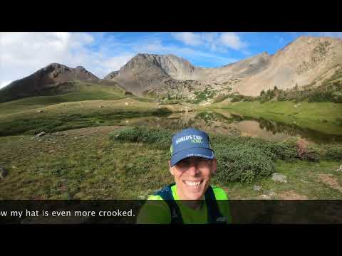
A high mountain race out of the Gould Community Center in Colorado's State Forest State Park, run between the Never Summer Mountains on the northern edge of Rocky Mountain National Park and the Medicine Bow Mountains north of Cameron Pass. There are two distances on two days: 39.2 miles on the Friday and 65.7 miles on the Saturday, and runners who want both can enter the Dirty Double and run them back to back. Long stretches sit above timberline between 10,000 and 12,000 feet, taking in two alpine peaks and four alpine lakes, and the ground runs from jeep and logging roads to bomber alpine trail to boulder fields and shin-deep mud. A 100km finish inside 24 hours qualifies for the Western States 100 lottery.
Gnar Runners first ran Never Summer in 2015, and 2026 was the twelfth running. The course has been tweaked several times, most significantly in 2020 and 2021, and has been essentially back on the original line since then. In 2024 the first cut-off was moved off the Diamond Aid Station and up to the North Diamond Summit so every runner would get more guaranteed time on course.
| Mile | Station | Cutoff | Crew access | Bag | Pacer | Med | To next |
|---|---|---|---|---|---|---|---|
| 0.00 | Start / Finish – Gould Community Center | ? | ? | ? | ? | ? | 11.40 |
| 11.40 | Michigan Ditch | ? | · | · | ? | ● | 8.10 |
| 19.50 | Diamond | ? | ● | ● | ? | ● | 3.40 |
| 22.90 |
North Diamond Summit
None · cell service
|
1:45pm | · | ? | ? | ? | 2.60 |
| 25.50 | Montgomery | ? | · | · | ? | ● | 6.10 |
| 31.60 | Ruby Jewel | 4:30pm | ● | ● | · | ● | 4.70 |
| 36.30 |
Kelly Lake
None · basic first aid
|
? | · | · | ? | ● | 4.60 |
| 40.90 | Clear Lake 1 | ? | · | ● | ? | ● | 4.40 |
| 45.30 | Clear Lake 2 | 10:45pm | · | ● | ? | ● | 6.20 |
| 51.50 | Canadian | 1:00am | ● | ● | ● | ● | 5.90 |
| 57.40 | Bockman | 3:00am | ● | ● | ● | ● | 6.20 |
| 63.60 | Ranger Lakes | ? | · | · | ? | ? | 2.10 |
| 65.70 | Finish – Gould Community Center | ? | ● | ● | ? | ? | ? |
Diamond Aid is located 3/4 of a mile east of the Seven Utes Trailhead (40.502198, -105.931914), the crew-access parking area. From the Gould Community Center, head East on Highway 14 for 4 miles to the turnoff on the right for the new Seven Utes Trailhead. Crews must park here and walk the 3/4 of a mile east to the aid station location.
Parking. Park at the Seven Utes Trailhead and walk 3/4 of a mile east to the aid station. No parking is allowed anywhere on Highway 14. Please do not arrive at the aid station before 7am. There are portable toilets at the parking area as well as at the aid station.
gnarrunners.comFrom the start/finish, it's just over 5mi west to the main park entrance. Make a right into the park and follow County Road 41 five miles to the Ruby Jewel Rd intersection. It is two miles from County Road 41 to the aid location and a mile from the Francisco Loop parking junction.
Parking. The Ruby Jewel Road past the Francisco Loop Road is open only to park visitors and volunteers. Crew cars park on the side of the Ruby Jewel Road before the Francisco Loop junction, or further down on County Road 41, then hike, run or bike 1 to 2 miles (400ft of gain) up the Ruby Jewel Road to the aid. No crew vehicles are allowed on Ruby Jewel Rd east of the Francisco Loop.
gnarrunners.comFrom the start/finish, it's just over 5mi west to the main park entrance. Make a right into the park and follow County Road 41 nine miles to Horse Corral / Campsites in a loop at the end of the main park road. Park in designated sites around the loop, then hike through the gate at the Northeast corner of the loop and 1mi along the dirt road to Canadian Aid.
Parking. Crew cars park at the trailhead at the northern end of County Road 41, three to four miles up the road from the Ruby Jewel intersection. It is about 1 mile of gently downhill dirt road to Canadian Aid. Do not block campsite or gate access. Pacers cannot leave a car here to retrieve later.
gnarrunners.comFrom the Canadian parking lot at the end of CR41, it is 5 miles back south to the left turn onto County Road 41B (Bockman Road). The aid and crew location is 3/4 of a mile down 41B. From the start/finish, it's just over 5mi west to the main park entrance, right into the park, follow County Road 41 four miles to the Bockman Road intersection, make a right, and go 3/4mi to the aid station.
Parking. Parking is allowed along the south (right) side of the road only, and before (west of) the trail crossing and aid station, to leave room for emergency vehicles. Do not drive into the Bockman Campground, especially after dark, and keep noise down at night. Pacers cannot leave a car here to retrieve later.
gnarrunners.com16 people have been out there with a camera or a microphone.
+ 8 more.
These are other people's work and we link straight to them. Watching costs nothing and needs no account. More of them: every race we hold, on film.
Nobody sees it until we have read it. No account, no sign-in.
This changes nothing on the page on its own. Somebody checks it against the race first.
Somebody watches it before it goes anywhere near this page. What we are after is footage of this course, on the ground. If it would be just as true of any other race, it is not this.
We want the address of the file the race publishes, not the file. We download it from there so the page can say where the line came from.
We read every one of these and we write back. Every fact here carries the source it came from, and the way a wrong one gets fixed is a person checking it against what you tell us.
Cutoffs move, races get postponed, lotteries open and close. We read the race's own sources and record where every fact came from. Put your email in and we will send you what changed, and where we read it.
No account, and nothing to cancel.
What happens to your email. Nothing else. I do not sell it, and I will not send you anything except this race changing. One click gets you out.
I keep this catalog because the information is scattered and hard to trust. Telling you when it moves is the same job.

NavRun builds your pacing from your own training, then turns it into a plan your crew can follow: when to leave and where to park.
Start free